Sunday, August 19, 2012

The Mustang Fire complex in North Fork

Donna and I went to visit with Jessie and Dan at their Mother Chukar' Cafe. It was very iffy whether the river road would be open or not because of the Mustang fire is now up to 80,000 acres. We made it to the cafe where for the price of a can of Moose Drool beer, Jessie will sit there and give you priceless information and stories of the area.

       I highly recommend Jessie's chips and salsa....all home made.


This was the first time we had seen the fire come down to the river level. Jessie explained that so far it was considered a good fire because it was burning slow and low...but all bets are off if the wind ever picks up.


Once when we stopped, this chukar looked bewildered at what was happening across the river.


His normal nesting area might have been right here.


We got lucky when we saw two different choppers picking up water out of the river.


It seems like this might be a dangerous job even without any wind in the canyon.


This helicopter was dropping water on an old cabin in the middle of the tree's.


If you look closely you can see the sprinkler system the firefighters have laid on the grounds to water down the buildings. There were 10 or more historic structures along the river road, some literally falling down, that either the forestry service or Idaho wanted protected. 


A different helicopter is picking up water right in front of us.


There is a reason why this particular helicopter has such a long bucket line compared to the red chopper.


Rich, from Colorado, was explaining to Donna and I why the much larger (didn't look that much larger to me though) helicopter needed a long line... because the longer blades prevented it from dropping down into the narrow river canyon. Rich also said that since retiring this last June his wife has seen less of him than when he was employed with the forestry service...he volunteer's now.


The firefighters here have gone to the other side of the river with gasoline, pumps and hoses in an effort to save one of the cabins the chopper was dumping water on earlier.


This magpie was guarding a day old road kill. If it wasn't for the unfortunate mountain sheep we might not have gotten close enough to photograph him, they are skittish.


Saturday, August 18, 2012

Butte, Anaconda and Wisdom, Montana

      Oh my gosh! We were on our way to Anaconda and Donna says, "Butte is just 10 miles up the road". I was thinking it was just a larger population of Montanans.

       Boy was I surprised when we drove in and saw all of those mine headframes...it was like Disneyland to me. The town was built on the "richest hill in history". Copper was king in the late 1800's and early 1900's due to the invention of electricity and then WW1 help too.


I believe there are still 12 or 13 headframes in the city of Butte and surrounding suburbs. Some are framed nicely as this one was within some of the old brick buildings.


Some headframes give the name and a bit of history, as in how many miners died on the mine.


Others had small house built onto them...


Butte is also famous for the thousands of historic buildings, some have been very lovingly preserved.


Some still have the original names on them.


As always in these western towns is the Chinese history to go with them.


Main street is as vibrant and well preserved as we have seen on our trip so far.


The Berkeley Pit. In 1955, after buying up many mines and some suburbs of Butte, the Berkeley Pit was opened. By the time it closed in 1982 it was more than a 1/2 mile wide and 1700 feet deep. They ground water is slowly filling up the pit with toxic water and won't get to ground level until 2018.


This is a "super fund" site because of acidity of the water. It's filled with arsenic, cobalt, magnesium, copper and zinc and this plant cleans about  100,000 gallons a day...way to little.


They are actually working a pit very near to the original "Berekely Pit".


Where the hell is ACLU? Just kidding. It's great to see this statue, "Our Lady of the Rockies",  a 90 foot tall figure overlooking the valley below.


Next town 30 miles away is Anaconda, which also had a huge copper pit. This is St. Peters, built in 1898 and still beautiful today.


While the mine closed in 1980 the town look lively and we did not see the typical boom-bust look of a town. One claim to fame for this town was in 1903 a socialist mayor, police force and town counsel were elected. It was short lived though.


This old smelting pot was out front of the aged copper shop in previous photo. The gate was open so that's an invitation in my book.


"The Montana Stack", when build in 1919 was the largest free standing masonry structure on earth. There are some who think this distinction still stands. Funny, this is a state park that you can never set foot in because the ground is so toxic you can not come near it. 


On our way home for the day we ventured towards Wisdom, Montana for dinner at "The Crossing". Here the Big Hole River crowds trees as it flows through the valley.


Birds...always birds! We saw this immature bald eagle sitting near the river.


We have passed these contraptions the last month without knowing what the are or what they do. Seems every other farm in the valley had one.


Talked to a lady we had befriended in Wisdom who filled in all the blanks. This is a "beaverslide". Invented right here in the valley over 100 years ago as a way of making hay loafs, instead of round or square bales. Not many farms still use it but this one, 18 miles out of the way, still does. The loaf in the middle is approximately 50 feet long and 12 feet tall.


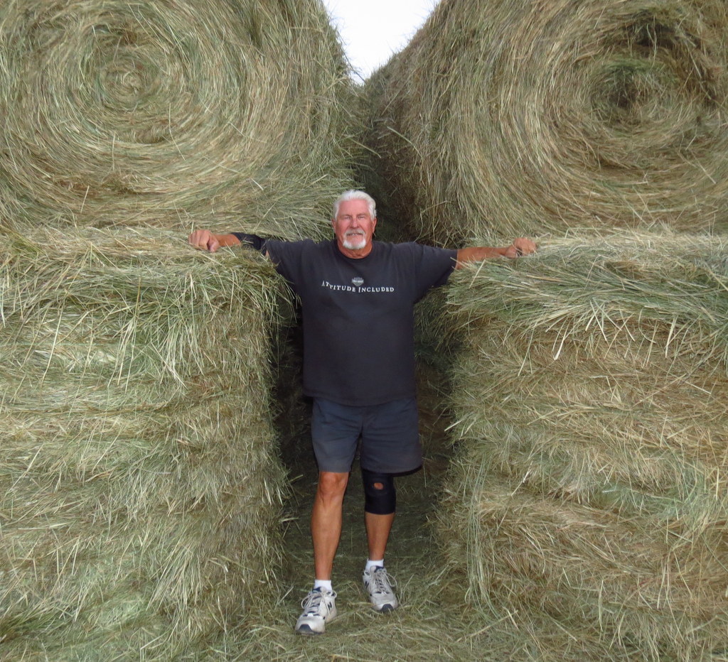
This is how we normally see hay baled in this part of the country.


This pile might be stacked very much the same as a loaf
so it's easy to see how the loaf (or haystack) fell out of favor.


Friday, August 17, 2012

Lemhi Pass to Dillon, Montana

Lemhi Pass road started for us in Idaho right off hwy 28 in the little town, really little with only one building I could see, of Tendoy, ID. Lemhi Pass is a National Historic Landmark that is a well maintained 30 mile dirt road up and over the Beaverhead and Salmon mountains.

This is the only store I could find and it had an appropriate vehicle out front.


Just 5 miles up the trail we passed this cowboy yelling at some cattle off the side of the road. Of course I had to stop and go over to talk to him about his job. Emmitt, and his beautiful pony, was out screaming at the cows to get out of the creek. This was confusing because we were in open range, on a hot day, and even I wanted to get in the creek and I don't wear a hair coat. Seems Emmitt has to go up there everyday to make an attempt to chase the cows away from the creek because of the protected "bull trout", that's according to fish & game (good ole' Uncle Sam). Pretty good job security Emmitt, huh?


This has to be one of the top 10 back-roads we have been on.


We enjoy stopping to read the historical markers but I have say as great as Chief Joseph and Lewis/Clark expedition were, if it wasn't for those three remarkable folks... there might only be as many historical markers as my hands has fingers.


Need I say more? haha


Although not heavily advertised or promoted, the pass has ample maps and guides along the way so you shouldn't get lost.


On a clear day at the top (smoke from fires below) Donna could of seen four states... Montana, Idaho, Oregon and Washington.


We got see some of the turn of the century cabins.


This one still had some of the sod roof attached to it.


It was nice to see along the nearly 30 drive, people have allowed the many log cabins to remain preserved or at the very least weather naturally.


The road took us 10 miles through this ranch .


There were three of these boards that we saw for different sections of the ranch that denotes past and present owners.


This beautiful example of a "jack-fence" ran for miles.


These pronghorn are a skittish breed. We stopped on the road to watch some archers unload from their truck. I have no idea how they plan on getting within 50 or so yards...they run like hell when we stopped here about 300 yards away.


Donna took this awesome shot of Armstead Island in the Clark Canyon Reservoir. I feel stupid because I questioned her wasting "even" digital film because of all the surrounding smoke or haze...what do I know?


LUNCH BREAK!!!


The Hotel Metlen in Dillon, Montana is for sale... can someone give me $1.2 million! Right near the railroad tracks so you would have a steady flow of all that "railroad" traffic. lol


I'd like to stay there just so I could say I did...check out the web site, beautiful interior.


Unfortunately we had just eaten 40 miles up the road. Anyone can eat a taco from a roach coach, but who can say that they had one in a "Taco Bus"? haha